File:Fort Oranje, Bonaire.jpg
From Eco Friendly Travels
Size of this preview: 800 × 450 pixels. Other resolutions: 320 × 180 pixels | 640 × 360 pixels | 1,024 × 576 pixels | 1,280 × 720 pixels | 4,347 × 2,445 pixels.
Original file (4,347 × 2,445 pixels, file size: 2.09 MB, MIME type: image/jpeg)
Summary
| Description |
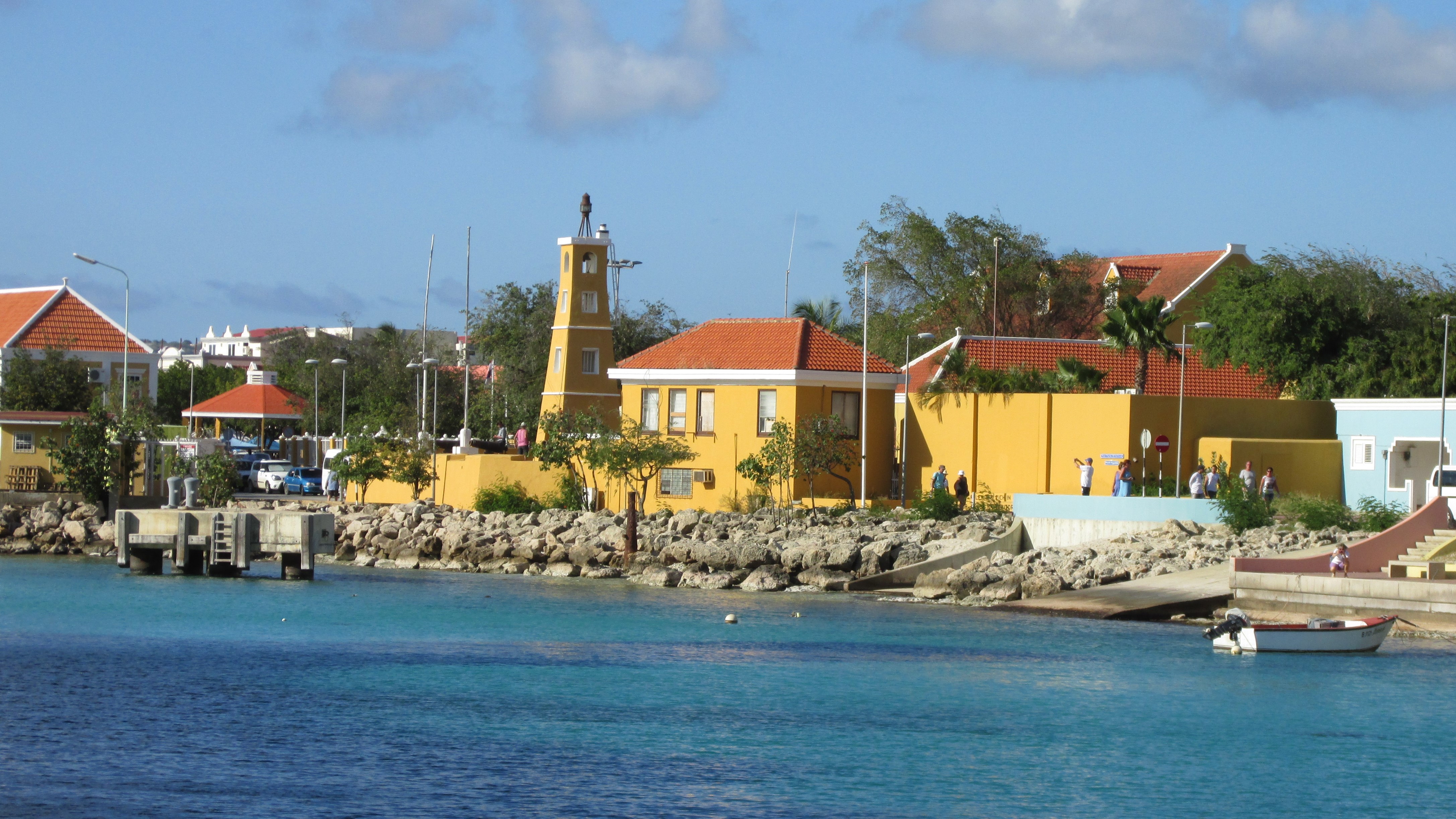
English: The Fort Oranje Lighthouse is located at the southern end of downtown Kralendijk on the island of Bonaire. It is next to the cruise terminal. The 44-foot lighthouse was built in 1932.
The picture was taken from our balcony on the Carnival Pride. Kralendijk is the capital of the island of Bonaire. Bonaire is part of the 'Caribbean Netherlands' (along with the islands of Sint Eustatius and Saba). They are referred to as the BES and are special municipalities of the Netherlands. Residents of the three islands are Dutch citizens. Bonaire sits off the coast of Venezuela and along with Aruba and Curacao is referred to as the ABC Islands. |
| Date | |
| Source | https://www.flickr.com/photos/124651729@N04/50736900988/ |
| Author | Larry Syverson |
| Camera location | | View this and other nearby images on: OpenStreetMap |
|---|
Licensing
This file is licensed under the Creative Commons Attribution-Share Alike 2.0 Generic license.
- You are free:
- to share – to copy, distribute and transmit the work
- to remix – to adapt the work
- Under the following conditions:
- attribution – You must give appropriate credit, provide a link to the license, and indicate if changes were made. You may do so in any reasonable manner, but not in any way that suggests the licensor endorses you or your use.
- share alike – If you remix, transform, or build upon the material, you must distribute your contributions under the same or compatible license as the original.
| This image was originally posted to Flickr by Stabbur's Master at https://flickr.com/photos/124651729@N04/50736900988. It was reviewed on 28 December 2020 by FlickreviewR 2 and was confirmed to be licensed under the terms of the cc-by-sa-2.0. |
File history
Click on a date/time to view the file as it appeared at that time.
| Date/Time | Thumbnail | Dimensions | User | Comment | |
|---|---|---|---|---|---|
| current | 17:20, 28 December 2020 | | 4,347 × 2,445 (2.09 MB) | CaroZam | Uploaded a work by Larry Syverson from https://www.flickr.com/photos/124651729@N04/50736900988/ with UploadWizard |
File usage
The following page uses this file: