File:20191129 Suriname 0182 Jodensavanne sRGB (49295410911).jpg
Original file (5,472 × 3,648 pixels, file size: 8.16 MB, MIME type: image/jpeg)
.jpg)
Summary
| Description |
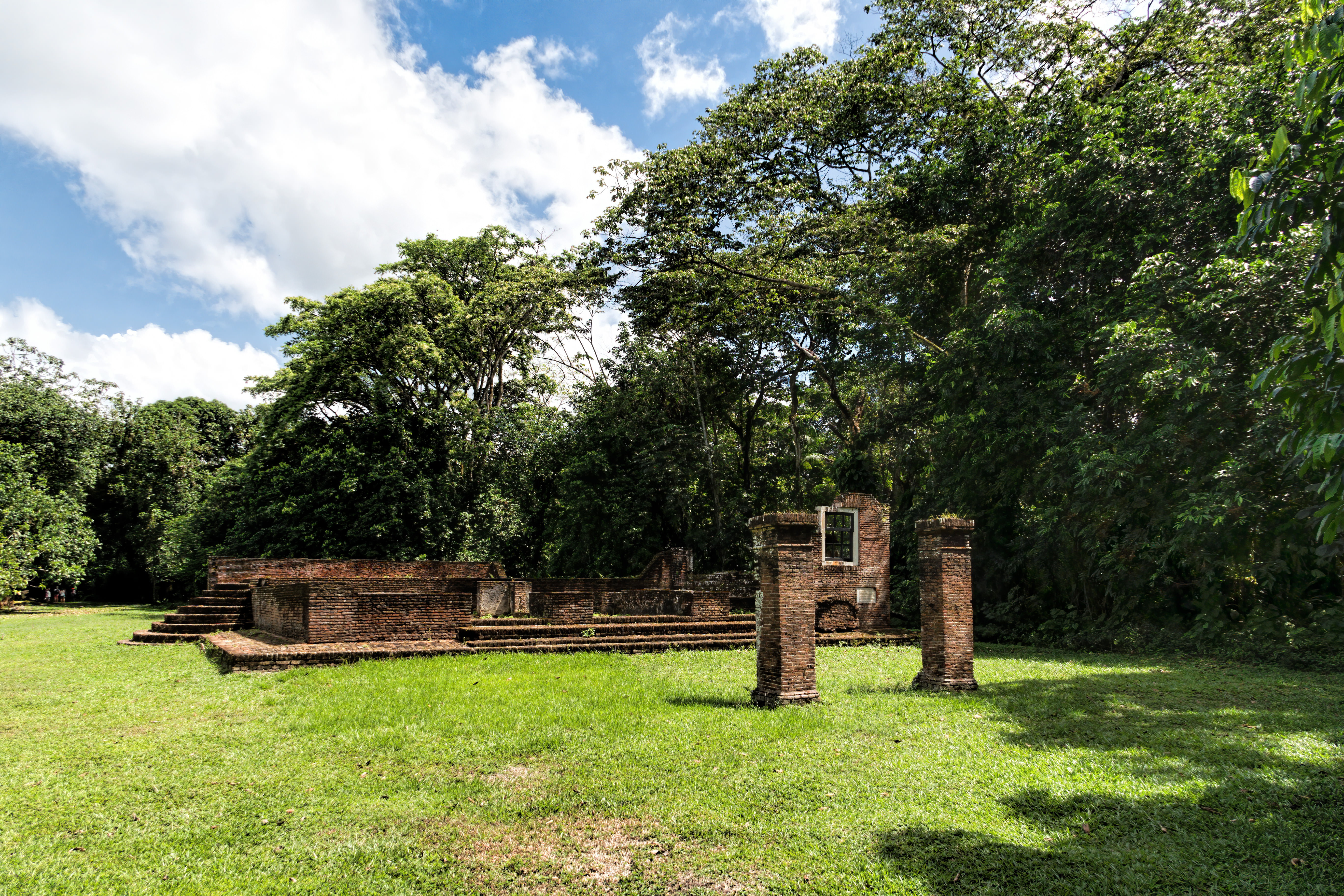
Ruins of the large brick synagogue named Berachah ve Shalom ('Blessing and Peace') that was erected in 1685. There was room for about 160 men on the main floor and for about 80 women on a balcony reached via two staircases. Jodensavanne (Jewish Savanna) was a settlement established by Jews in the 17th century on the right bank of the Suriname River at Cassipora Creek. The 1639 decision by the English government to permit Sephardic [Spanish/Portuguese] Jews to settle in Suriname prompted the first wave of Jews to the area who fled the Inquistion and came to Torarica, Suriname’s first capital. In 1652 a second wave of 1,200 Jews migrating under the leadership of Lord Francis Willoughby, Governor of Barbados, arrived and settled around Cassipora Creek. A third wave of Jews from French Guiana (previously expelled from Brazil in 1654) joined them in 1664. To boost the Suriname economy by attracting more planters, the Jewish community was granted freedom of religion in 1665, a right retained when the Dutch acquired Suriname in 1667. In 1669 the Jews received official permission to form a community with a synagogue and cemetery protected by a Jewish militia—creating the only Jewish diaspora group with political and religious autonomy prior to Israel’s founding— which led to the establishment of Jodensavanne on a hill overlooking the Suriname River. A large brick synagogue named Berachah ve Shalom ('Blessing and Peace') was erected in 1685. For a brief while the Jewish plantation owners had permission to give their slaves Saturdays off instead of Sundays. By the end of the 1600’s, ‘Jerusalem by the riverside’ comprised nearly 600 Jews owning over 40 plantations and around 9,000 slaves. After years of prosperity, the area went into decline starting in the 1780’s. A massive fire in 1832 started by a slave rebellion destroyed Jodensavanne prompting its abandonment although services continued in the synagogue until 1860. On Google Earth: Jodensavanne 5°25'45.23"N, 54°59'4.36"W |
| Date | |
| Source | 20191129_Suriname_0182 Jodensavanne sRGB |
| Author | Dan Lundberg |
| Camera location | | View this and other nearby images on: OpenStreetMap |
|---|
.jpg¶ms=005.429354_N_-054.984276_E_globe:Earth_type:camera_source:Flickr_&language=en)
Licensing
- You are free:
- to share – to copy, distribute and transmit the work
- to remix – to adapt the work
- Under the following conditions:
- attribution – You must give appropriate credit, provide a link to the license, and indicate if changes were made. You may do so in any reasonable manner, but not in any way that suggests the licensor endorses you or your use.
- share alike – If you remix, transform, or build upon the material, you must distribute your contributions under the same or compatible license as the original.
| This image was originally posted to Flickr by Dan Lundberg at https://flickr.com/photos/9508280@N07/49295410911 (archive). It was reviewed on 13 January 2020 by FlickreviewR 2 and was confirmed to be licensed under the terms of the cc-by-sa-2.0. |
File history
Click on a date/time to view the file as it appeared at that time.
| Date/Time | Thumbnail | Dimensions | User | Comment | |
|---|---|---|---|---|---|
| current | 11:38, 13 January 2020 | | 5,472 × 3,648 (8.16 MB) | Geagea | Transferred from Flickr via #flickr2commons |
File usage
The following page uses this file:
.jpg)