File:Cordillera del Medio-Laguna del Pelado.jpg
From Eco Friendly Travels
Size of this preview: 800 × 434 pixels. Other resolutions: 320 × 174 pixels | 640 × 347 pixels | 1,024 × 555 pixels | 1,280 × 694 pixels | 3,648 × 1,978 pixels.
Original file (3,648 × 1,978 pixels, file size: 1.03 MB, MIME type: image/jpeg)
Summary
| Description |
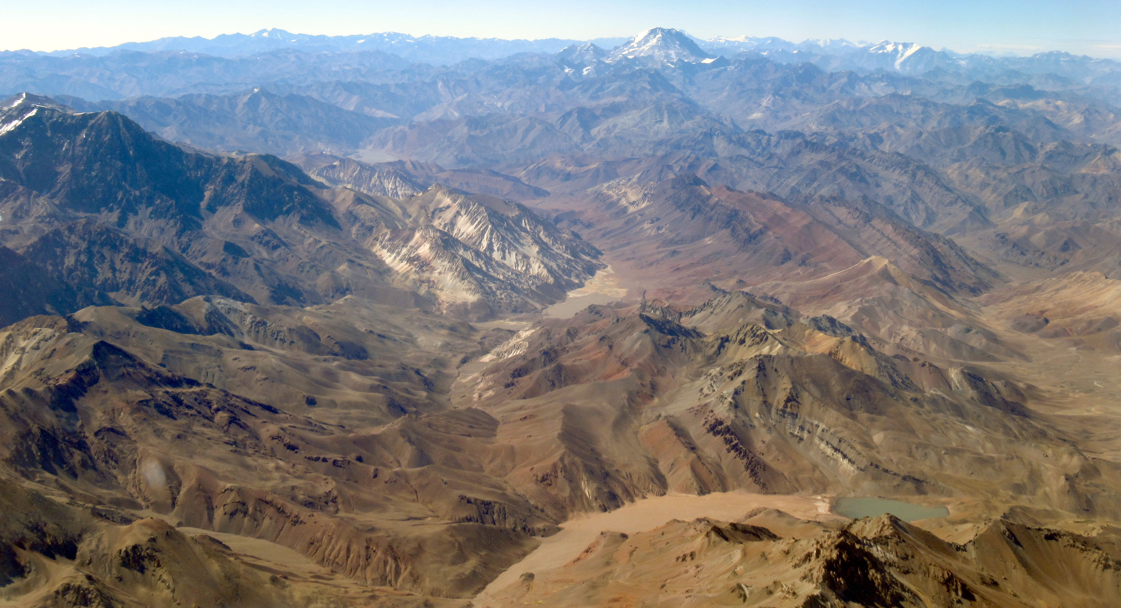
Español: A la izquierda las faldas occidentales del Cerro Mesa y al medio la Cordillera del Medio, con el río Mercedario de por medio, todo en territorio argentino. Abajo, la Laguna del Pelado en territorio chileno. En el horizonte el Aconcagua.
Deutsch: Links die Westhänge des Cerro Mesa und in der Mitte die Cordillera del Medio, dazwischen der Fluss Mercedario, alles auf argentinischem Gebiet. Unten, die Laguna del Pelado auf chilenischem Gebiet. Am Horizont der Aconcagua.
English: On the left the western slopes of Cerro Mesa and in the middle the Cordillera del Medio, with the Mercedario River in between, all in Argentine territory. Below, the Laguna del Pelado in Chilean territory. On the horizon the Aconcagua. |
| Date | 3 December 2021, 09:52:14 (according to Exif data) |
| Source | Own work |
| Author | WeHaKa |
| Permission (Reusing this file) |
This file is licensed under the Creative Commons Attribution-Share Alike 4.0 International license. Attribution: WeHaKa
|
| Camera location | | View this and other nearby images on: OpenStreetMap |
|---|
| Object location | | View this and other nearby images on: OpenStreetMap |
|---|
| Object location | | View this and other nearby images on: OpenStreetMap |
|---|
| Object location | | View this and other nearby images on: OpenStreetMap |
|---|
| Object location | | View this and other nearby images on: OpenStreetMap |
|---|
| Annotations | This image is annotated: View the annotations at Commons |
File history
Click on a date/time to view the file as it appeared at that time.
| Date/Time | Thumbnail | Dimensions | User | Comment | |
|---|---|---|---|---|---|
| current | 01:15, 27 May 2022 | | 3,648 × 1,978 (1.03 MB) | WeHaKa | {{Information |description = {{es|A la izquierda las faldas occidentales del Cerro Mesa y al medio la Cordillera del Medio, con el río Mercedario de por medio, todo en territorio argentino. Abajo, la Laguna del Pelado en territorio chileno. En el horizonte el Aconcagua.}} {{de|Links die Westhänge des Cerro Mesa und in der Mitte die Cordillera del Medio, dazwischen der Fluss Mercedario, alles auf argentinischem Gebiet. Unten, die Laguna del Pelado auf chilenischem Gebiet. Am Horizont der... |
File usage
The following page uses this file: