File:Rynok Square in Lviv (8673864339).jpg
Original file (4,288 × 2,848 pixels, file size: 3.13 MB, MIME type: image/jpeg)
.jpg)
Summary
| Description |
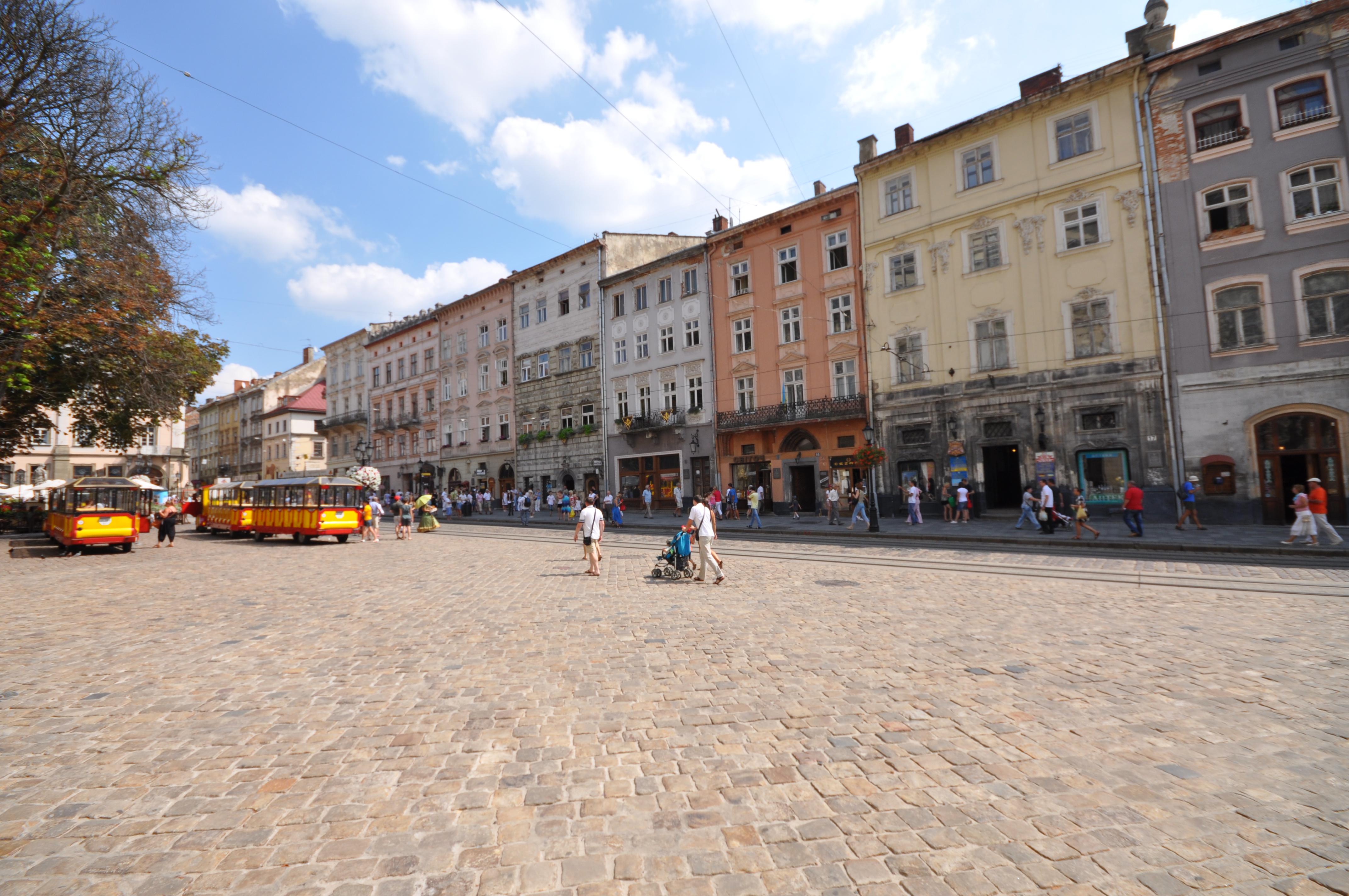
The Rynok Square in Lviv is a central square of the city of Lviv, Ukraine. It was planned in the second half of the 14th century, following granting city rights by Polish king Casimir III, who annexed Red Ruthenia. The king ordered Lviv to be moved more to the south, where a new city was built to the plan of a traditional European settlement: a central square surrounded by living quarters and fortifications. Old, Ruthenian Lviv had become a suburb of the new city. The square is rectangular in shape, with measurements of 142 meters by 129 meters and with two streets radiating out of every corner. In the middle there was a row of houses, with its southern wall made by the Town Hall. However, when in 1825 the tower of the Town Hall burned, all adjacent houses were demolished and a new hall, with a 65-meter tower, was built in 1835 by architects J. Markl and F. Trescher. Around the square, there are 44 tenement houses, which represent several architectural styles, from Renaissance to Modernism. In the four corners, there are fountains—wells from 1793, probably designed by Hartman Witwer. The sculptures represent four Greek mythological figures: Neptune, Diana, Amphitrite and Adonis. In front of the Town Hall, there was a pillory. In 1998 the Market Place, together with the historic city center of Lviv, was recognized as a UNESCO world heritage site [Wikipedia.org] |
| Date | |
| Source |
|
| Author | Jorge Láscar from Australia |
| Camera location | | View this and other nearby images on: OpenStreetMap |
|---|
.jpg¶ms=049.841466_N_0024.031265_E_globe:Earth_type:camera_source:Flickr_&language=en)
Licensing
- You are free:
- to share – to copy, distribute and transmit the work
- to remix – to adapt the work
- Under the following conditions:
- attribution – You must give appropriate credit, provide a link to the license, and indicate if changes were made. You may do so in any reasonable manner, but not in any way that suggests the licensor endorses you or your use.
| This image, originally posted to Flickr, was reviewed on 10 August 2013 by the administrator or reviewer File Upload Bot (Magnus Manske), who confirmed that it was available on Flickr under the stated license on that date. |
File history
Click on a date/time to view the file as it appeared at that time.
| Date/Time | Thumbnail | Dimensions | User | Comment | |
|---|---|---|---|---|---|
| current | 14:20, 10 August 2013 | | 4,288 × 2,848 (3.13 MB) | File Upload Bot (Magnus Manske) | Transferred from Flickr by User:High Contrast |
File usage
The following page uses this file:
.jpg)