File:Utica, New York - 05 - Panoramic view of Steuben Park - 20210828.jpg
From Eco Friendly Travels

Size of this preview: 800 × 480 pixels. Other resolutions: 320 × 192 pixels | 1,024 × 614 pixels | 1,280 × 768 pixels | 3,919 × 2,351 pixels.
Original file (3,919 × 2,351 pixels, file size: 3.2 MB, MIME type: image/jpeg)
Summary
| Description |
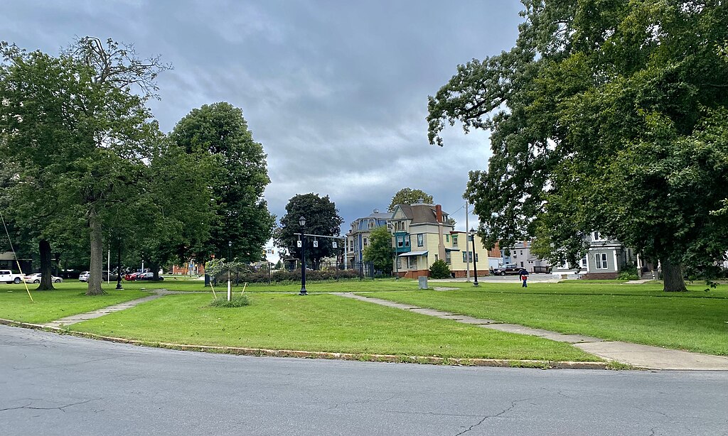
English: A panoramic view of Steuben Park in Utica, New York, as seen in August 2021. One of the earliest plots of land in Utica to be set aside for use as a park, Steuben Park shows up in historical records as early as 1827, at which point the surrounding neighborhood was an off-the-beaten-path backwater in the outskirts of town. However, that would begin to change in 1830, when prominent attorney and soon-to-be U.S. Congressman Rutger B. Miller built a spacious mansion in this vicinity designed by eminent architect Philip Hooker. Derided initially as "Miller's Folly", the construction was actually a prescient harbinger, as the basis of the local economy was on the cusp of a transition from westward shipping of people and goods along the Mohawk River and the Erie Canal to manufacturing, especially of textiles and knit goods. The newly wealthy industrialists who were spearheading this new economy sought desirable places to live away from the increasingly congested city center, and the area around Steuben Park was one of the places where they clustered, and to this day, most of the housing in the district dates to the middle 19th century. |
| Date | |
| Source | Own work |
| Author | Andre Carrotflower |
| Camera location | | View this and other nearby images on: OpenStreetMap |
|---|
Licensing
I, the copyright holder of this work, hereby publish it under the following license:
This file is licensed under the Creative Commons Attribution-Share Alike 4.0 International license.
- You are free:
- to share – to copy, distribute and transmit the work
- to remix – to adapt the work
- Under the following conditions:
- attribution – You must give appropriate credit, provide a link to the license, and indicate if changes were made. You may do so in any reasonable manner, but not in any way that suggests the licensor endorses you or your use.
- share alike – If you remix, transform, or build upon the material, you must distribute your contributions under the same or compatible license as the original.
File history
Click on a date/time to view the file as it appeared at that time.
| Date/Time | Thumbnail | Dimensions | User | Comment | |
|---|---|---|---|---|---|
| current | 16:13, 20 September 2021 | | 3,919 × 2,351 (3.2 MB) | Andre Carrotflower | Uploaded own work with UploadWizard |
File usage
The following page uses this file: